
Ourika Valley
A greener mountain valley known for riverside villages, terraced fields and the Setti Fatma waterfalls.
The Ourika Valley follows a river south from Marrakech into the Atlas foothills. Its lower villages are an easy introduction to mountain scenery; higher up, Setti Fatma offers a livelier walking route and a series of waterfalls reached by uneven paths. Conditions and crowd levels change through the year, so we set realistic expectations for the walk and the return journey.

Route, directions & local access
A private vehicle follows the Ourika road southeast from Marrakech. The valley’s first settlements are around an hour away; Setti Fatma is farther along the same valley. The exact drive depends on the chosen walk, pickup location and traffic. The waterfall path is rocky and may be slippery; suitable shoes are essential.
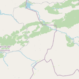
Use the map for orientation and the directions link for a live route. Distances and arrival times are estimates: traffic, weather, road works and the exact pickup point can change the journey. For a booked trip, your driver confirms the pickup, stops and return timing in writing.
Further destination information: Visit Morocco official travel guide ↗




Planning your visit
Can I visit Ourika Valley as a day trip from Marrakech?
That depends on the route and the time available. The tour pages linked here explain which itineraries are offered as a day trip and when an overnight stop is more comfortable. For longer distances, we recommend a multi-day route.
Can you arrange transport and a local guide?
Yes. Send your dates, group size and preferred pace. We will confirm the transfer, guide, inclusions and total price in a written proposal before you decide.
Are the map and driving times live?
The embedded map is for orientation. Google Maps directions may show changing traffic estimates; your driver confirms the actual pickup and schedule for a booked trip.
Ask our local team to plan this stop → · Explore all Morocco destinations